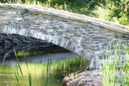
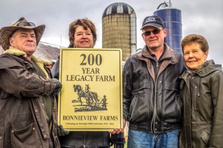
Close
Skip to content
Tay Valley Township logo
  • Link to Resident Services Resident Services
    • A - Z Services
    • Age Friendly
    • Animal Control
    • Anniversary and Birthday Certificates
    • Applications, Licenses and Permits
    • Building
    • Business Directory
    • By-Laws
    • Cemeteries
    • Commissioner of Oaths
    • Drainage and Flooding
    • Education and Schools
    • Emergency Services
    • Events Calendar
    • Garbage and Recycling
    • Health Services
    • Line Fences Act
    • Lottery Licensing
    • New to the Community
    • News and Public Notices
    • Planning and Development
    • Property Taxes
    • Recreation
    • Report It
    • Roads
    • Transportation
    • Utilities and Telecommunications
    • Link to Applications, Licenses and Permits

      Applications, Licenses and Permits

    • Link to Recreation

      Recreation

  • Link to Discover Tay Valley Discover Tay Valley
    • 200th Anniversary Celebrations
    • Business Directory
    • Events Calendar
    • Festivals and Events
    • Getting Here
    • Green Energy & Climate Change
    • History and Historic Sites
    • Library
    • Local Foods and Flavours
    • Maps
    • Nature and Outdoors
    • Photo Gallery
    • Recreation
    • Tourism
    • Transportation
    • Link to History and Historic Sites

      History and Historic Sites

    • Link to Nature and Outdoors

      Nature and Outdoors

  • Link to Doing Business Doing Business
    • Building
    • Business Directory
    • Community Profile
    • Economic Development
    • Lottery Licensing
    • Planning and Development
    • Refreshment Vehicle Licensing
    • Strategic Plan
    • Tax Rates
    • Tenders
    • Link to Community Profile

      Community Profile

    • Link to Economic Development

      Economic Development

  • Link to Municipal Government Municipal Government
    • A - Z Services
    • Accessibility
    • Budget and Financial Reports
    • By-Laws
    • Career Opportunities
    • Committees and Boards
    • Contact Us
    • Council
    • Elections
    • Municipal Freedom of Information and Protection of Privacy
    • All News
    • Reports and Publications
    • Service Delivery Review
    • Strategic Plan
    • Tenders
    • Website Feedback
    • Link to Committees and Boards

      Committees and Boards

    • Link to Strategic Plan

      Strategic Plan

  • 200th Anniversary Celebrations
  • Business Directory
  • Events Calendar
  • Festivals and Events
  • Getting Here
  • Green Energy & Climate Change
  • History and Historic Sites
  • Library
  • Local Foods and Flavours
  • Maps
  • Nature and Outdoors
  • Photo Gallery
  • Recreation
  • Tourism
  • Transportation
Minus icon Plus icon Plus icon
  Print Icon  
Share IconShare
  •  

Contact(s)

History and Historic Sites

Home/Discover Tay Valley/History and Historic Sites

Tay Valley Township contains a wealth of historical farms, buildings and landscapes as well as numerous cultural activities and attractions. The history of our Township is unique and represents a story to be explored and discovered.

History of Tay Valley Township

Tay Valley Township was formerly three separate townships: North Burgess, South Sherbrooke, and Bathurst. The first Township to be settled was North Burgess.

Tay Valley Township Ward Map

Township of North Burgess

The former Township of North Burgess was settled by a group of Scottish and Irish immigrants and soldiers from the War of 1812-14.  The first residents established homes and farms along the first stretch of cleared land, which would later become known as the Scotch Line. North Burgess was named for Rev. Thomas Burgess in 1794, an important religious leader who later became Bishop of Salisbury. 

Within the former township is the historical hamlet of Stanleyville, originally called Micaville, whose first residents were Irish Catholic immigrants. It thrived on the business of the Silver Queen Mica mine, now located in Murphy’s Point Provincial Park. Before mica, lumber was an important trade and the Black Creek lumber yard was a vital part of this industry.

Murphys Point Provincial Park celebrates the area’s rich history. For thousands of years, Native peoples hunted and gathered along the Rideau.  The area that is now Murphys Point was surveyed in 1812 and European settlement followed on the site of the restored McParlan House and Burgess Mill ruins.  The saw mill (circa 1820 to 1870) was one of the earliest on Big Rideau Lake.  The land along the Rideau Canal system has evolved into a recreational playground and in 2007 the Rideau Canal was named by UNESCO as a World Heritage Site. 

Township of Bathurst

The Township of Bathurst was surveyed in 1816 for settlement by both British emigrants and ex 1812-1814 War soldiers and seamen. The Township was then settled by Irish and Scottish immigrants, most of whom were farmers or military personnel. It was named for Henry Bathurst, the third Earl of Bathurst, who served as Secretary of State for War and the Colonies from 1812 to 1827.

The villages and hamlets of Bathurst include Glen Tay with its three mills, Dewitt’s Corners, Balderson known for cheese production, Fallbrook home to four mills and two hotels, Playfairville, Harper home to artisan potters, Wemyss and Armstrongs Corners.

Township of South Sherbrooke

South Sherbrooke was surveyed in 1819 with its name was adopted from Sir John Coape Sherbooke, who served in the British Army for 30 years and then became Lieutenant Governor of Nova Scotia from 1811 to 1816.  General Sherbrooke also served as Governor General of British North America from 1816-1818.

At the time of survey, South Sherbrooke was one of many townships within the District of Bathurst.   Like much of the surrounding area, South Sherbrooke was settled by Scottish and Irish immigrants. For many years after settlement in 1821, farmers struggled and persevered with the harsh terrain of the Canadian Shield. 

The hamlets and villages of South Sherbrooke include: Maberly with five milling operations, five stores, two churches, a hotel and the area’s own telephone company, Bolingbrooke with four mills, a store and a lumbering trade employing hundreds was a regional center of business in the colonial period , Althorpe, and Rokeby, which was the first settlement of this township.

Tay Valley Township

The Bathurst, Burgess & Sherbrooke Township was created in 1998 with the amalgamation of the former townships of Bathurst, North Burgess and South Sherbrooke. It was renamed Tay Valley Township in 2002, in recognition of the river that meanders across our landscape continuing its historic role of linking communities.

© 2014 Tay Valley Township

Home Accessibility Feedback Photo Gallery Privacy Sitemap Weather
Designed by eSolutions
217 Harper Rd, Perth, Ontario, K7H 3C6, Phone: (613)267-5353, Toll-Free: 1-800-810-0161